Multi-Parcel Tax Deed Purchases: Assemblage Pitfalls, Boundary Disputes, and Survey Risks Every Investor Must Evaluate Before Bidding
Assembling multiple tax deed parcels into a single developable tract looks like a high-upside strategy—but the gap between two lots on a county map and the reality on the ground can be enormous. Boundary disputes, inconsistent legal descriptions, and missing survey monuments routinely trap investors who buy adjacent parcels at auction without doing the geometric math first. Before you treat a cluster of distressed parcels as a ready-made opportunity, you need to understand every layer of spatial and title risk that survives the deed.
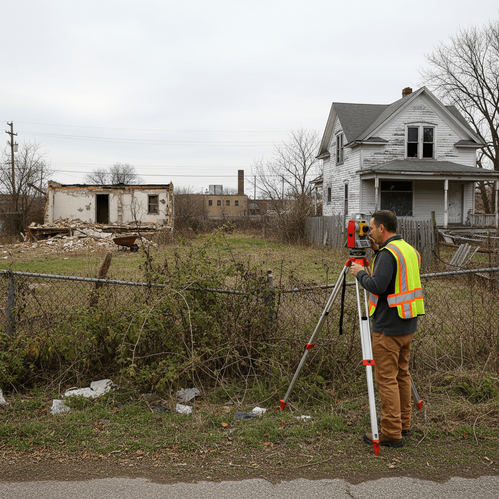
Why Multi-Parcel Assemblage at Tax Deed Auctions Is Different from a Normal Purchase
When you buy a single parcel at a tax deed auction, your title risk is essentially one-dimensional: does this deed extinguish what it's supposed to extinguish, and what liens survive? When you buy two or more adjacent parcels—especially with the intent to merge them into a larger developable footprint—you introduce a second dimension of risk: do these parcels actually fit together the way the county map implies? Tax deed auctions transfer whatever interest the taxing authority holds, which is defined by the legal description in the delinquent tax record. That description was typically inherited from the original subdivision plat, an older metes-and-bounds survey, or sometimes both, and discrepancies between them are extremely common.
The county's parcel identification number (PIN) system is an administrative tool for billing purposes, not a legal boundary determination. Two PINs that appear to share a common boundary on a GIS viewer may in fact have an overlap, a gap, or a jog in their shared line that only a licensed land surveyor can resolve. Investors who plan to combine parcels, re-plat them, or develop them as a single unit need to budget for a boundary survey before bidding—not after.
- County GIS maps are not legal surveys—treat them as a starting point only
- Legal descriptions in tax records may conflict with subdivision plats
- Adjacent PINs can have gaps or overlaps invisible on a digital map
- Survey monuments may be missing, moved, or destroyed on long-neglected parcels
The Assemblage Gap Problem: When Two Parcels Don't Actually Touch
One of the most expensive surprises in multi-parcel tax deed investing is discovering that two parcels you purchased do not share a common boundary at all. This happens when an intervening strip of land—sometimes only a few feet wide—was never deeded to either adjacent owner. These strips can originate from old subdivision errors, railroad right-of-way abandonments, alley vacations that were never completed, or simply from rounding errors in metes-and-bounds descriptions drafted decades ago.
If that intervening strip has its own separate legal existence and was not on the tax delinquency list, you did not acquire it at auction. It may be owned by an unknown heir, a dissolved corporation, or the municipality. In some jurisdictions a narrow gap parcel can be claimed through adverse possession, but that process takes years and requires continuous, open possession—neither of which is guaranteed when you've just acquired a vacant lot at auction. The practical consequence is that your two parcels cannot be merged, re-platted, or permitted as a single development site until the gap is resolved, which typically requires a quiet title action or a separate negotiated acquisition.
- Search for intervening parcels by running a legal description chain, not just a visual GIS comparison
- Ask the county assessor whether any strip parcels in the area are on the tax rolls under a separate PIN
- Abandoned alley and right-of-way strips may revert to adjacent owners by state statute—verify which parcels benefit
Overlapping Deeds and Conflicting Legal Descriptions
The mirror image of a gap is an overlap—where two parcels claim the same strip of ground. Overlapping deeds are surprisingly common in areas that were subdivided multiple times or where original survey lines were run with instruments far less precise than modern GPS-based equipment. When you acquire both parcels at a tax deed auction, you technically hold two claims to the same strip, but that does not resolve the conflict. A title insurer will see the overlap as a defect on both parcels, and a lender will decline to finance either one.
Overlapping legal descriptions also create practical problems when you try to build or fence. A neighboring property owner who traces their chain of title through the other competing description has an arguable claim to a portion of what you believe you own. Resolving an overlap requires a boundary line agreement executed and recorded by all affected parties, or a court judgment if they won't cooperate. Either path adds time and attorney fees that should be factored into your maximum bid before the auction, not discovered afterward.
- Pull the full metes-and-bounds description for every adjacent parcel, not just the ones you plan to buy
- Look for calls to the same monument or bearing from two different deeds—a classic signal of overlap
- A boundary line agreement is the typical remedy, but it requires a cooperative neighbor
Survey Monument Issues on Long-Abandoned Parcels
Tax-delinquent properties are often the most neglected parcels in a county. Years of deferred maintenance, vegetation overgrowth, construction on adjacent lots, and road widening projects all work against the survival of original survey monuments—the physical iron pins, concrete monuments, or blazed trees that define where a boundary actually sits on the ground. When monuments are missing, a surveyor must perform a boundary retracement, searching for record evidence, witness corners, and chain-of-title documentation to reconstruct where the line was originally set. This is more expensive and time-consuming than a straightforward survey, and the result may be disputed by adjacent owners who hired their own surveyor with a different interpretation.
For investors buying multiple parcels in a blighted area where many lots have been vacant for extended periods, monument destruction is nearly universal. You should budget for full boundary retracement surveys on every parcel in the assemblage, not just the aggregate perimeter. If your plan depends on a precise configuration—say, a specific frontage width or minimum lot depth required by local zoning for a particular use—verify those dimensions with a surveyor's professional opinion before you commit your capital at auction.
- Order a boundary retracement survey, not just a location survey, for older vacant parcels
- Missing monuments increase survey cost and introduce the risk of a neighbor challenging the result
- Confirm zoning-required dimensions (frontage, depth, area) with an actual survey, not the assessor's data
Re-Platting, Lot Line Adjustments, and Local Government Approval Risk
Even after you successfully assemble adjacent parcels and confirm the boundaries are clean, merging them into a single parcel typically requires a formal administrative process: a lot consolidation, lot line adjustment, or re-plat, depending on your jurisdiction. Each process involves a different set of approvals, fees, and timelines. In many counties a lot consolidation requires approval from the planning department and recording a new deed or plat amendment. A full re-plat—required when you are creating new lots or changing public dedications—goes through the planning commission and may trigger infrastructure improvement requirements, dedications of additional right-of-way, or updated drainage studies.
Local governments occasionally decline re-plat applications on parcels acquired at tax deed auction if there are outstanding code violations on the site, unresolved environmental issues, or if the proposed use conflicts with a recently adopted area plan. None of these approval risks are visible in the auction listing. Your exit strategy—whether it's selling to a developer, building yourself, or re-selling individual lots—depends entirely on getting that approval, and you should assess the regulatory landscape with the planning department before you bid, not after.
- Confirm whether a lot consolidation or full re-plat is required in your county before assuming a simple merger
- Ask the planning department whether any moratoriums, area plans, or pending rezonings affect the target parcels
- Outstanding code violations on any parcel in the assemblage can block re-plat approval in many jurisdictions
- Infrastructure dedication requirements triggered by re-platting can significantly increase your total project cost
How to Evaluate Assemblage Risk Before You Bid
The core discipline for multi-parcel tax deed investing is completing your spatial and title due diligence before the auction clock runs out—not assuming the pieces will fit together because they look adjacent on a screen. Start with the legal descriptions: pull them from the delinquent tax certificate or the most recent deed in the chain, not from the GIS layer. Compare the calls against the subdivision plat. Look for any reference to vacated easements, abandoned alleys, or fractional lot remnants. Then engage a licensed surveyor for at least a desktop review of the legal descriptions—a full field survey is ideal but even a professional opinion on whether the descriptions are consistent can flag problems early.
Run a title search on every parcel in the assemblage independently. The survival of a lien on one parcel does not automatically affect the others, but a judgment lien recorded against the same delinquent owner may attach to all parcels simultaneously. Check for separately assessed strips between your target lots. Confirm that any county road, drainage easement, or utility corridor between the parcels has been formally vacated before assuming it is buildable. Tools that aggregate parcel data, flag surviving encumbrances, and score the risk profile of individual auction properties can help you build a systematic pre-bid checklist and avoid costly surprises after the gavel falls.
- Pull legal descriptions from the deed chain, not the GIS layer
- Commission a desktop legal description review from a licensed surveyor before bidding on any assemblage
- Search for surviving liens on each parcel independently—they may differ
- Verify vacation of any roads, alleys, or easements between target parcels before treating the corridor as buildable
- Use a pre-bid risk checklist to evaluate every parcel individually before combining them in your financial model
It's the 3% that bankrupts beginners
95% of tax liens get paid. TaxDeedIQ finds the risky ones, the junk land, the surviving IRS lien, before you bid.
Try it free for 7 daysMulti-Parcel Tax Deed Purchases FAQ
If I buy two adjacent tax deed parcels, do they automatically merge into one property?
No. Adjacent parcels do not merge automatically. In most jurisdictions you must file a lot consolidation application, a lot line adjustment, or a re-plat with the local planning or assessor's office and have it approved and recorded. Until that happens, each parcel retains its separate legal identity, tax account, and any encumbrances attached to it individually.
Can a county GIS map be used to confirm that two parcels share a boundary?
A GIS map is an administrative visualization tool, not a legal survey. It can suggest that parcels are adjacent, but it cannot confirm the legal boundary line. Gaps, overlaps, and misaligned descriptions are common and are only detectable by comparing the actual metes-and-bounds legal descriptions or by commissioning a boundary survey from a licensed land surveyor.
What happens if I discover a gap parcel between two lots I already purchased at auction?
You do not own the gap parcel unless it was separately listed and you purchased it. Your options typically include locating the current owner and negotiating a purchase, filing a quiet title action if ownership is unclear, or pursuing adverse possession if the statutory requirements can be met—a process that takes years and varies significantly by state. Until the gap is resolved, you generally cannot merge the parcels or develop them as a contiguous site. Consult a real estate attorney licensed in the relevant state before pursuing any of these remedies.
Do surviving liens on one parcel in an assemblage affect the other parcels I purchased?
Not automatically—each parcel carries its own title history and any liens attached to it individually. However, a judgment lien recorded against a prior owner may have attached to multiple parcels simultaneously if that owner held title to all of them at the time the judgment was docketed. A separate title search on each parcel in the assemblage is the only way to confirm which encumbrances survived the tax deed sale on each one.
How does TaxDeedIQ help investors evaluating multi-parcel assemblage opportunities?
TaxDeedIQ assigns a Safety Score to individual auction parcels and flags risk categories—such as surviving liens, federal tax lien redemption windows, flood zone exposure, and homestead status—before you bid. For an assemblage strategy, you can evaluate each target parcel independently to understand what encumbrances and risk layers are present on each one before calculating whether the combined acquisition pencils out. The platform surfaces what can go wrong at the parcel level so you can make a more informed decision before committing capital at auction.
More guides
- Tax Deed vs Tax Lien: What's the Difference? (2026 Guide)
- Is Tax Deed Investing Safe? 6 Risks to Check Before You Bid
- Tax Deed Surplus Funds: How Overbid Recovery Works
- Redeemable Deed States Explained (Georgia, Texas & More)
- Waterfront and Marina Properties at Tax Deed Auctions: Riparian Rights, Dock Permits, and the Risks Every Investor Must Evaluate Before Bidding
- Condominiums at Tax Deed Auctions: HOA Super-Liens, CC&R Restrictions, and the Risks Every Investor Must Evaluate Before Bidding
Informational only, not legal or investment advice. Confirm rules with the county and consult a licensed professional before bidding.